| GISdevelopment.net ---> AARS ---> ACRS 2000 ---> GIS & Data Integration |
GIS Database of The
Environmental Information
Sharav Munkhtuya*, Batjantsan Enkhtsetseg**
GIS Specialist, Information and Computer Center of Ministry of Nature and Environment, Mongolia
Email: mtt@magicnet.mn, mtuya@yahoo.com*, enkheeb@hotmail.com**
Sharav Munkhtuya*, Batjantsan Enkhtsetseg**
GIS Specialist, Information and Computer Center of Ministry of Nature and Environment, Mongolia
Email: mtt@magicnet.mn, mtuya@yahoo.com*, enkheeb@hotmail.com**
Keywords: ICC - Information and Computer Center, MNE - Ministry of Nature and Environment, GIS - Geographic Information System
Abstract
In this paper we will present description of Mongolian Environmental GIS database design and some results on implementation of database establishment. The Environmental GIS database is a important part of Mongolian Environmental database project, which is supervised by the Ministry of Nature and Environment (MNE) of Mongolia and implemented by the Information and Computer Center (ICC) of the MNE. The Environmental GIS Database has 4 categories, such as global, national, provincial (aimag) and local.
- Global level database includes 1:1 000 000 and lower scale maps
- National level database includes maps with the scale of 1:1 000 000 up to 1:100 000
- Provincial level database includes regional and aimag area maps with the scale of 1:200 000 up to 1:50 000 scale
- Local level database includes maps of 1:50 000 scale and higher.
Introduction
Mongolia is situated in Central Asia. Different regions of the country differ considerably from each other by structure of relief and elevation. The medium elevation of the territory is 1580 m above the sea level. About 9.7% is a forest, 75.8 % is a grassland, 1% is water and 0.4 % is an urban of the country. There are nearly 540 rivers and 3000 lakes, but they are situated in the north half of the country. Such geographic traits of Mongolia determine the severe nature, sharp continental climate and frequently unfavorable weather conditions. The country has extensive natural resources, minerals, fossil fuels, forests and vast areas of grassland, much of which is suitable for grazing livestock. As yet, the major portion of these resources is untapped. Mongolia with its nomadic animal husbandry is one of the most dependent countries from nature and climate. The global warming and climate change problems are affecting to the land cover changes. Different kind of natural disasters such as drought, flood, heavy winter (zud), land degradation, desertification or steppe and forest fires also has influences on land cover changes. Extensive exploitation in mining, increasing number of livestock, preparation of timber wood is causing land and pasture degradation, deforestation.
The comprehensive data and information about natural resources, environmental state is essential for the policy on sustainable development of our country and well living of our nation. Understanding it the Ministry of Nature and Environment has a item in its key objectives, which says: "Maintain database on land, underground resources, water, forest, atmosphere, flora and fauna; organize the implementation of ecological policy on protection and proper use of the above resources".
The establishment of Environmental Information System, which can supply by information about nature and environment to the user community starting from policy makers, through the business people ending on everyone, is an important factor to achieve above mentioned objective. Such Environmental Information System should include components like Information Database, Network and Tools for analyzing and decision support. One important part of the Environmental Information Database is a Geographic Information Database.
The Information and Computer Center of the Ministry for Nature and Environment is an executing organization for creation of Environmental Information Database including GIS component. Establishment of GIS database includes following steps such as investigation of existing information sources, ongoing activities, selection and collection of maps, prioritizing and entering into GIS, evaluation, updating and documentation. Since 1930's in Mongolia started to produce various topographic and thematic maps with different scale by Mongolian scientists jointly with others specially soviet scientists in the field of geology, geography, geomorphology, hydrology, landuse, forestry, climatology, archeology and ecosystem etc. Because of size our territory information amount is very huge and most of maps are not updated and old.
Structure of Geographic Information Database
The Geographic Information Database of the Environmental Information has 3 levels such as national, regional and local. The national level includes all the thematic maps of 1:500,000 scale and above, regional level will have maps of 1:100,000 and above and local level includes maps of 1:100,000 scale and below. But scale of maps in each level will depend from the existence of source information, its accuracy, actuality and quality. First step of implementation is entering all thematic maps of 1:1,000,000 scale for the National level database and meantime for other levels maps will be entered under the request. The attribute information of maps is in Mongolian language and many of them are in Russian. So our database will have attributes in Mongolian, Russian and English. In case of topographic map Mongolia has 1:100,000 scale, which is made by former Soviet Union specialists, and has a 1024 sheets. This map will be basis of National and Regional level geographic information database.
GIS Hardware and Software
The ICC has ArcInfo 7.03 GIS systems on platforms Sun Sparcstation 20, Vaxstation 90 and ArcView 3.1 on PC and PCI image processing system on Silicon Graphics Indy workstations. GIS system includes also Calcomp 9500 digitizer, HP designjet 750c plotter, Calcomp Classic pen plotter, and A4 size scanner. Those systems are used for the Geographic Information Database.
Current Status of Geographic Information Database
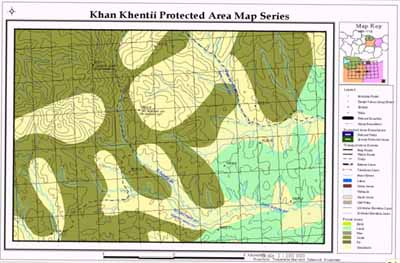
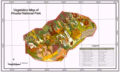
The lists of GIS database are in Table1 and Table2, examples of existing maps in database are shown in Figure 1 and Figure 2.
| No. | Map | Scale | Data type | Original authors | Year of the release |
| 1 | Administrative boundaries and centers | 1:500 000 | Polygon, line point | 1999 | |
| 2 | Vegetation | 1:1 000 000 | polygon | Russian & Mongolian Scientists | 1981 |
| 3 | Fodder resource | 1:1 000 000 | polygon | B.Dashnyam | 1981 |
| 4 | Soil type | 1:1 000 000 | polygon | - " - | 1981 |
| 5 | Underground water | 1:1 000 000 | polygon | - " - | 1981 |
| 6 | Landscape | 1:1 000 000 | polygon | - " - | 1981 |
| 7 | Geological structure | 1:1 000 000 | polygon | - " - | 1981 |
| 8 | Forest | 1:1 000 000 | polygon | V.I.Sukhikh, N.Gombojav, Ts.Bolooj | 1981 |
| 9 | Ecosystem | 1:1 000 000 | polygon | Gunin (Russia) | 1990 |
| 10 | Protected areas | 1:1 000 000 | polygon | PA Admin. Of MNE | 1999 |
| 11 | Haying& grassland map | 1:1 000 000 | Buyanorshih | 1995 | |
| 12 | Vegetation map | 1:1 500 000 | polygon | A.A.Unatov, B.Dashnyam | 1961 |
| 13 | Distribution of Mammals | 1:6 000 000 | polygon | ||
| 14 | Paleogenic period | 1:6 000 000 | polygon | ||
| 15 | Jurassic period | 1:6 000 000 | polygon | ||
| 16 | Endemic plants | 1:9 000 000 | point | ||
| 17 | Medical plants | 1:9 000 000 | point | ||
| 18 | Fish | 1:9 000 000 | polygon | ||
| 19 | Rare mammals | 1:9 000 000 | polygon | ||
| 20 | Rare birds | 1:9 000 000 | polygon | ||
| 21 | Number of mammal species | 1:9 000 000 | polygon | ||
| 22 | Insect groups | 1:9 000 000 | polygon | ||
| 23 | Vegetation regionalization map | 1:10 000 000 | polygon | A.A.Unatov,B.Dashnyam renewed by N.Olziihutag | (1979)(1984). |
| 24 | Soil-geographic zonation | 1:12 000 000 | polygon |
| No | Map | Scale | Original authors | Coverage |
| 1 | Topographic maps | 1:100 000 | Uvs lake hollow, Khan Khentii region, Selenge aimag, Some parts of Tuv aimag, Ulaanbaatar city, Khuvsgul National Park | |
| 2 | Vegetation maps | 1:25 000 | Gorkhi-TereljKhustai | |
| 3 | Soil map | 1:25 000 | Gorkhi-TereljKhustai | |
| 4 | Water | 1:25 000 | Khustai | |
| 5 | Forest | 1:50 000 | Khuder sum (Selenge aimag) | |
| 6 | Pasture and fodder | 1:200 000 | Selenge aimag | |
| 7 | Underground water | 1:1 000 000 | Selenge, Tuv |
Figure 1. Example of National Level GIS Database
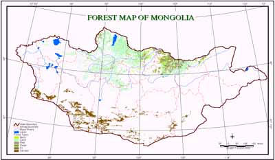
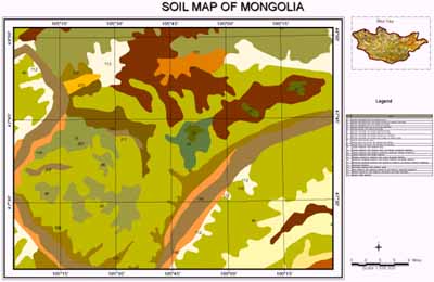
Figure 2. Example of Regional and Local Level GIS Database