| GISdevelopment.net ---> AARS ---> ACRS 1999 ---> Topics Including Education |
The Development of national
GPS network in Mongolia
M. Saandar
Mon Map Engineering Services Co., Ltd
r. 502, 5h Floor, Sarora Hotel , Seoul street 12/6
Ulaanbaatar 210646 Mongolia
Tel:+9761327824 Fax:+9761327824
E-mail: monmap@magicnet.mn, msaandar@mongol.net
Mon Map Engineering Services Co., Ltd
r. 502, 5h Floor, Sarora Hotel , Seoul street 12/6
Ulaanbaatar 210646 Mongolia
Tel:+9761327824 Fax:+9761327824
E-mail: monmap@magicnet.mn, msaandar@mongol.net
Mongolia, situated around the center of the Asian Continent, is an landlocked country bordering the Russia to the north west and surrounded by the people's Republic of China to the east, west and south. Mongolia has the area of approximately 1, 566,500 .sq km with poprlation of approximately 2,5 million people and athe poprlatjion dinsitay beibg 1.4 persons per sq. km.
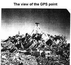
The Mongolian GPS network consists of 34 stations and one GPS stations serving approximately 49000-sq.km. The GPS network survey was executed on the existing second order triangulation points to approximately estimate seven parameter datum conversion coefficients between WGS-84 and local system Krassovsky and to establish a primary high accuracy GPS network with ITRF connection in Mongolia.

The GPS network survey project carried out and financed by Monmap Engineering Services Co. Ltd., Ulaanbaatar in cooperation with the Ministry of Defense, Mongolia. The GPS network survey measurement made by Trimble 4000 Ssi receivers and data of the GPS network processed and adjusted by Trimble GPS survey (version 2.3) and Trimnet Plus software
Project summary
Mongolian Network
| Project | Mongolian Network |
| Supervisor | Dr. Saandar |
| Date Created | 2/4/98 10:46 |
| Date Last Accessed | 5/13/98 0:50 |
| Project Directory | C:\GPSURVEY\prqiects\ Mongolia |
| Antenna Type | Compact L1/L2w/Grounnd Plane |
| Antenna Measurement Method | Measured to bottom of notch on ground plane |
| Antenna Group | GPSurvey |
| Receiver Type | 4000551 |
| Coordinate System | Geographic |
| Zone | WGS84 |
| Linear Unit | Meter |
| Time zone | Greenwich Mean Time: 0:00 |
| Number of Stations | 34 |
| Number of Baselines | 110 |
| No. of Continuous Kinematics Soles | 0 |
End of Report
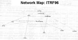
ITPF96 Connectionq
|
Project |
ITRF96 |
|
Supervisor |
Dr. Saandar |
|
Date Created |
2/10/98 6:08 |
|
Date Last Accessed |
5/13/98 0:55 |
|
Project Directory |
C:\GPSUREVEY\projects\ITRF96 |
|
Antenna Type |
Compact l1/l2w/Ground Plane |
|
Antenna Measurement Method |
Measured to bottom of antenna mount |
|
Antenna Group |
GPSurney |
|
Receiver Type |
400OSSi |
|
Coordinate System |
Geographic |
|
Zone |
WGS84 |
|
Linear Unit |
Meter |
|
Timezone |
Greenwich Mean Time:0:00 |
|
Number of station |
11 |
|
Number of Baselines |
46 |
|
No. of Continuous Kinematics Soles |
0 |
End of Report
The GPS network survey work executed according to the following document which Is published by Federal Geodetic Control Committee, USA: Geometric Geodetic Accuracy Standard and Specifications for GPS Relative Positioning Techniques, 1989 and Final Draft Geospatial Positioning Accuracy Standards Part2: Standards for Geodetic Networks by Federal Geographic Data Committee Secretariat, April 1998.
The Processed Baselines
The Repeated Baselines