| GISdevelopment.net ---> AARS ---> ACRS 1999 ---> Image Processing |
Zhijun Wang, Deren Li
Wuhan Technical University of Surveying and Mapping
Wuhan, Hubei, P.R. China
Tel: (667-2)326-9967, Fax: (66-2)326-9086
E-mail: zwang@wtusm.edu.cn , dli@wtusm.edu.cn
Abstract
Several image fusion methods exists but hardly can they keep a balance between improving the spatial resolution and maintaining the color as original color composite. A PBIM method has original suggested to add TM reflective band spatial details to LANDSAT TM thermal band YTM-6 images in region with sufficient topography. Our research shows that the idea PBIM can also be integrated into traditional HIS transform to fuse images. The result shows that the method of what we call IM-HIS (Intensity Modulated HIS transform) can improve the spatial details while preserve to color of original color composite.
Introduction
As the launch of a series of remote sense satellites, there are various multi-resolution images and multi-spectral images available nowadays. Many works have recognized the benefit of merging high spectral resolution (or spectral diversity) and high spatial resolution images, particularly in land mapping applications [12]. The integration of spectrally and spatially complementary remote multi-sensor data can facilitate visual and automatic image interpretation [8]. For example, the merging of SPOT panchromatic image data (SOPT PAN), having a spatial resolution 10m, with Landsat thematic mapper TM images, having six reflective bands each of 30m resolution, can take advantages of SPOT higher spatial resolution and Land sat multi-spectral and provide useful information for natural resource monitoring. Many researches concerning on how to merge multi-sensor images have been done, it was found that multi-sensor data merging is a trade-off between the spectral information from a low spatial-high spectral resolution sensor and the spatial structure from a high spatial-low spectral resolution sensor [3]. Several methods exist to modulate lower resolution multi-spectral images using a higher resolution panchromatic image, particular for color composites such as HIS (Intensity-Hue-Saturation), PCA (Principal Component Analysis), PBIM, the Brovey transform ARSIS, etc. [1][2][3][4][5][6][7][8][9][10][12]. But those methods normally improve the spatial resolution while distort the color composite, it is still necessary to investigate how to improve the spatial resolution of fused images while distort the color composite, it is still necessary to investigate how to improve the spatial resolution of color appearance of the images some papers introduce the wavelet transform methods which can achieve best spectral and spatial quality [3] [4] [5]. But some experiments also show that wavelet transform methods is complicated, time consuming and not always work well.[5] [6] [10],it is still a research topic to investigate how to use wavelets for image fusion. This paper tries to explain the IMIHS(Modulated Intensity-hue-Saturated) method which can improve the image resolution while preserve the color as original color composites. Although many methods have been proposed for the merging of high spectral and high spatial resolution images, but very few propose an assessment of the quality of the resulting synthetic images besides the visual inspection approach. Luclen Wald [12] proposed an assessment approach which three properties of the resulting synthetic images need to be checked. We have used this assessment approach in our research.
IHS Transform
The Intensity-Hue-Saturation (IHS) transform is widely used as a image fusion technique to exploit the complementary nature of multi-sensor image data. Taken SPOT PAN images and TM 743 (RGB) as a example. Normally it consists of the following steps. (1) resembling RGB (TM 743) images to SPOT PAN pixel size; (2) convert RGB images to HIS images; (3) substitute the intensity channel with a co-registered SPOT PAN image;(4) transform the H,S and the substituted SPOT PAN image back image back to RGB space by the inverse HIS transform. It is popular and the result color composite will have a higher spatial resolution (10m) in terms of topographic texture information. In this algorithm, Intensity (I) represents the brightness of a color, and saturation (S) represents the purity of a color while Hue (H) represents the average wavelength of the color. But the technique may cause color distortion in the color composites using spectral the color composites using spectral bands beyond the spectral range of the panchromatic image, in which case P and I are no spectral similar. For those, who are interested in human interpretation, they find that their years-experiences are not useful anymore. According to their experience, Dark green in TM 743 color combination represents forest area, but after HIS transform, the detail information of TM image is enhanced, but the color is changed, nobody can make sure that which color represents the forest area. It is necessary to look for a way to improve the spatial while preserve the can. Liu, et. Al. [9] introduce a PBIM (Pixel Block Intensity Modulation) methods to adding spatial details from simulated YM panchromatic images to TM 6 thermal image. It seems that it can be integrated into IHS transform to modulate the intensity channel I. BY this process, the result of the transform improve the spatial resolution while can keep he color of the original images.
Pixel Block Intensity modulation (PBIM)
Modulation (PBIM)
A PBIM method has original suggested to add spatial details to LANDSAT TM thermal band TM-6 images in region with sufficient topography. [9] but the idea is also applicable, as a general method for data fusion of multi-spectral and panchromatic images with different spatial resolution [9].
Taken one band TM -6, having 120m *120m resolution and one band TM -4 30m30m resolution as an example. One pixel of TM -6 covering 120m* 120m are makes one TM-6 pixel equivalent to 16 TM -4 pixels. TM-6 data is first resembling as pixel blocks with 16 identical pixels to match the image size of TM-4. The PBIM method automatically detects a TM-6 pixel block and restores the topographic variation within the TM-6 pixel block based on TM-4 image data. This method
improves the topographic variation caused by topography to 30m resolution while maintaining the average DN (Digital Number) of 120m * 120m area. Figure 1 represents one pixel area of TM-6 image while Figure 2 represents the corresponding 16 pixels. T6-I (I = 1,…., 16) represents the pixel values after applying PBIM methods. Equation (2) gives the computation formulation.
| T6-1 | T6-2 | T6-3 | T6-4 |
| T6-5 | T6-6 | T6-7 | T6-8 |
| T6-9 | T6-10 | T6-11 | T6-12 |
| T6-13 | T6-14 | T6-15 | T6-16 |
Figure 1. Pixel block of TM-6 (120 resolution)
Equation
(1) computes the average DN of the pixel block area equivalent to one TM-6
pixel area. Equation (3) shows that the average DN of one TM -6 pixel area
after applying PBIM methods equals original TM-6 pixel value, this means
after PBIM modulation, the brightness of one TM-6 pixel area maintain
unchanged. While equation (4) shows that the details of TM-4 is added to
TM-6 pixels block. By this way we can achieve that the spatial improved
while the color is maintained.
Intensity modulated IHS
Transform
As mentioned in section 2, HS transform normally consists
of four steps. IM-HIS (Intensity modulated IHS transform) integrates PBIM
transform with IHS transform. It will consist of 4 steps. Taken SPOT PAN
image channel and TM 543 as an example, the steps are: (1) re-samplings
TM543 (RGB) to pixel size of SPOT PAN, (2) convert RGB image to IHS image
space, (3) apply PBIM methods to add SPOT PAN details to I(Intensity image
channel). (4) Convert IHS image channels back to RGB space. In the first
step, the re-sampling operator has an influence upon the final result. In
most cases, a Bi-cubic interpolator offers a good compromise between the
accuracy of the result and the required computer time.
| T4-1 | T4-2 | T4-3 | T4-1 |
| T4-5 | T4-6 | T4-7 | T4-8 |
| T4-9 | T4-10 | T4-11 | T4-12 |
| T4-13 | T4-14 | T4-15 | T4-16 |
Figure 2. Pixel block of TM-7 (30m
resolution)
Experimental and Conclusion
Two experiments
have been carried out in our paper. The first experiment is to use PBIM
methods to add spatial details of TM-4 to thermal band TM-6. the second
experiment is to fuse SPOT PAN image to TM-543 RGB images by using of
IM-IHS (Intensity modulated IHS transform). While the result of fused SPOT
PAN and TM 543 by using normal IHS transform is also presented for
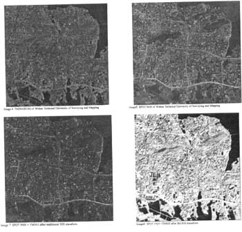
comparison. The quality of the resulting fused images is usually by visual
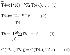
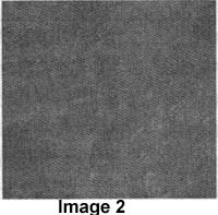
inspection. The visual inspection of the resulting image of Image3 and
Image6 shows that the high spatial image details have been added to the
low spatial-high spectral images. And the color of the original color
composite is preserved as original. But in same case there are some blocky
noise along each TM-6 pixel block, in order to solve this problem, we have
filtered the averaged image before going to using PBIM formula (3).
Luclean Wald [12] presented his work with some criteria to provide a
quantitative assessment of the synthetic images. He suggested that these
synthetic images must have the three following properties. First, the
synthetic images, once degraded to its original resolution, should be as
identical as possible to the original image. Second, the synthetic image,
should be as identical as possible to the image that the corresponding
sensor would observe with the highest resolution. Third, the
multi-spectral set of synthetic images should be as identical as possible
to the multi-spectral set of images that the corresponding sensor would
observe with the highest resolution. According to this proposed approach,
we have done the following:
1. Degrade Image3 from 30m
resolution to 120m resolution, and check the histogram of degraded image3
and image2. from table 1, it shows that Im-IHS method satisfies suggested
first property.
Table 1
| Image 2 | Degrade image 3 | |
| Mean | 122.7 | 122.7 |
| Std. Deviation | 4 | 4 |
| Median | 123 | 123 |
2. Visual comparison between image 4, image 6 and image 7, and
statistics comparison of R,G,B channels of each image. NO any histogram
modification is done before the checking. Visual inspection and Table 2
shows that IM-IHS method satisfies second and the third property and has
been effects that IHS both from visual inspection and statistics
reports.
Table 2
| Image 4 | Image 6 | Image 7 | |
| Red Channel | |||
| Mean | 56 | 55 | 86 |
| Std. Deviation | 25 | 26 | 23 |
| Median 61 | 58 | 85 | |
| Green Channel | |||
| Std. Deviation | 51 | 50 | 81 |
| Mean | 18 | 19 | 16 |
| Median | 53 | 51 | 80 |
| Blue Channel | |||
| Mean | 41 | 40 | 71 |
| Std. Deviation | 12 | 15 | 20 |
| Median | 40 | 37 | 70 |
According to our research, we can conclude that IM-IHS method can be
used to merge the high resolution spatial details into low spatial-high
spectral images while preserve the color as original composites. It has
much better effects by comparison with the traditional IHS
methods. 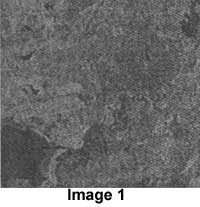
Reference
- F, Sunar, N. Musaoglu, Merging multi-resolution SPOT P and Landsat
TM data: the effects and advantages, INT. J. Remote sensing, 1998, Vol.
19, No. 2 p219-224.
- E.M. Schestselaar, Fusion by the IHS transform: should we use
cylindrical or spherical coordinates. INT. J. Remote Sensing, 1998, Vol.
19, NO. 4 p759-765.
- J. Zhou, D.L.CIVCO and J.A. Silander, A wavelet transform method to
merge Landsat TM and SPOT panchromatic data. INT. J. Remote Sensing,
1998, Vol. 19, No. 4 p759-765.
- Deren Li, Julian Shao, Wavelets model based image fusion and
restoration. Journal of Wuhan Technical University of Surveying and
Mapping. 1996, Sept. Vol. 21, NO. 3(In Chinese).
- Jiabin Sun, Jilin Li, Jun li, Multi-source remote sensing image
fusion. Journal of Remote Sensing, Vol. 2., No.1, Feb. 1998.(In
Chinese)
- Honglian Fan, Xiaomei Yang, Yuyan Du, Application of Principle
component transform and inverse transform for image fusion of ADEOS
AVNIR XS and PAN. Remote Sensing technology and application, 1998,
Vol.13 No. 3 , (In Chinese)
- Coulogner, T. Ranchin, V.P. Valtonen and L. Wald Benefit of the
future SPOT-5 and Data fusion to urban roads mapping. INT. J. remote
Sensing, 1998, Vol. 19, NO.8, p1519-1532.
- X. Li and A.G.O. Yeh, Principle component analysis of stacked
multi-temporal images for the monitoring of rapid urban expansion in the
Pearl River Delta.
- Liu Jian Guo and J. McM. Moore, Pixel block intensity modulation:
adding spatial detail to TM band 6 thermal imagery. INT. J. remote
Sensing, 1998, Vol. 19, NO.13, p2477-2491.
- Mi Zhou, Chuangrong Li, Multi-resolution analysis based image fusion
algorithm research. M.Sc. thesis, 1998. China Remote Sensing Satellite
Ground Station. (In Chinese).
- Kenneth R. Castleman, Digital image processing, 1997, Prentice
Hall.
- Luclen Wald, Thierry Ranchin, and Marc Mangolini, Fusion of
satellite images of different spatial resolutions: assessing the quality
of resulting images, PE&RS, June
1997.