| GISdevelopment.net ---> AARS ---> ACRS 1996 ---> Water Resources / Hydrology |
The use of Radar Remote
Sensing Imageries for Developments in Southern Coastal Belt of Sri-Lanka
T.K.D.
Tennakoon
NARA-Sri-Lanka
Firoz Verijee
RSI Canada
Abstract NARA-Sri-Lanka
Firoz Verijee
RSI Canada
Sri Lanka is Island in Indian Ocean with 1700km length coastline and 6900000 km2 EEZ. From ancient times it has been divided into three parts Ruhunu (Southern and Southern eastern), Maya (Central) and Pihiti (eastern and central eastern). The Ruhunu was well developed part of the Island in the ancient times. Unfortunately due to effects of Colonialism this part backards compare to other part of the country. This was persuaded to the critical social problems in the country in a roundabout way. The present government takes task for the rapid development of Southern region. The development of Industries, fisheries, harbours, land uses, Agriculture sectors are highly concerned about government vision of Southern development. The wide range f opportunities of Radar remote sensing imageries may useful for investigations, for monitoring and in many aspects of mentioned development. Recent shuttled commercial basis Canadian satellite RADARSATI imageries could be use in many event in various industries. This paper discuss the places where Radar remote sensing imageries could utilize.
Radarsat imageries could be used for activities, such as Coastal Zone Mapping, Ship Detection, Oil Spill detection and Monitoring, Aquaculture site detection, Bathymetry survey, to read Mesoscale Features and wave Spectra. There are many industries which could promote in Southern Sri_Lanka and get servies from the Radarsat imageries. To investigate suitable sites, to monitor various industries.
Introduction of Radarsat -1
Radarsat was the first Canadian remote sensing satellite which was alunched in 1995. It is C-band sar satellite which also includes a steerable antenna and changeable image scale or swath with. As well, it is the first operationally oriented commercial radar satellite. Radarsat imageries having significant advantage compare to the other satellite resolution in;
- surface roughness (Radarsat can distinguish textural differences
created by forest clearest, agricultural village and crop practices to
name a few)
- Topography (Radar backscatter is better one for slopes facing the
radar sensor than for slopes facing away from the sensor)
- Land/water boundaries (Smooth water surface tend to reflect microwave energy away from the satellite sensor. Land surface tend to be rougher and reflect more energy back to the satellite.
- sharp contract between land/water boundaries
- Man made Features (Man-made features such as buildings and ships strongly reflect microwave energy back to the SAR sensor)
- Moisture (The amount of moisture in the soil or on vegetation affect the amount of SAR backscatter).
Agriculture: Crop identifications/delineation, Soil moisture
Cartography: (base mapping topographic mapping interferometer, stereo radargrammetry)
Hydrology (Soil moisture, water shed studied/flood plain mapping) Forestry (board class mapping harvest mapping), Land use (Urban mapping, target detection, transportation network)
Disaster (flood monitoring, land slide identification, oil slick identifications), Geology (Oil and gas exploration, mineral exploration, natural hazard monitoring)
Coastal/Open Oceans (Ocean features, wave spectra, coastal interaction aquaculture identification, ship monitoring).
Depend on the requirements and conditions, different types of radar beams can be used, some of are illustrate in table1.
Southern coastline of Sri-Lanka's is length in 400 km of sandy beaches, extensive lagoons and estuaries, mangroves coastline lie reefs of coral or sandstone and shallow beds of coastal and estuarine seagrass. This coastal belt has significant for the economy of the country. Some could be classified as follows.
- Sun, sand surf of Southern sea beaches are Sri lanka's major tourist
attractions that also offer recreational opportunities for there people.
- Its natural coastal habitats coral reefs, estuaries and lagoons,
mangroves, tidal flats and barrier beaches are immensely productive,
essential for nation growth and rich reservoirs of generic resources.
- It bears significant minerals, such as Monazite bearing beach sands,
Silica sands, Miocene limestone, Kaolin, China clay and Peat.
- It hosts over 80% of the industrial units in the region, many of which are highly polluted.
Coastal erosion Erosion endangers Southern beaches and adjoining coastal land. Wind, waves and currents constantly pounding the coasts, diminishing beaches and eroding bluffs. Specially in the Coastal belt from Bentota to Hikkaduwa facing this problem. This area mainly depends on tourism, and hundreds of hoteliers were affected due to erosion. The Coast Conservation Department (CCD) is working on coast protection. There many problems came out due to rubble dumping as a coast protection solution. With careful study or wave spectrum of this area optimum solutions can be seek.
Sand mining Mining of Sand from beaches and specially river months are causing increasingly serious coastal erosion and salt water intrusion, despite permit controls exercised by the Coast Conservation Department. CCD found that nearly 200,000 cubes of sand mined in the coastal stretch from the Southern coastal stretch. This could me monitored easily by the satellite imageries.
Habitat degradation and over exploitation of resources Coastal habitats are under enormous pressure because many are small specially vulnerable to degradation. The mangroves, that exist have become severely reduced by overuse, abuse and conversion to other uses. Still there are major projection to monitor, to digress Mangroves and other coastal habitats. Here radarsat imageries could use in several ways, to monitor, to identify location and its densities etc.
Coastal pollution Major source are oil pollution from shipping and fishing craft, discharge of industrial effluents, sewage and domestic waste. Five miles off the Southern and South-western coasts a major international shipping route carries estimated annual traffic of over 5,000 tankers, posing risks of an accidental oil spill. Some time its makes a risk and inestimable damages. The country has been suffering for many years due to lack of sources to get information about the oil spills. Here radarsat imageries could play a significant role to get information within a shorter period.
Conclusions and discussion
The discussed actives are on going in the Southern coastal belt of Sri-Lanka. These are tragically very significant sectors must be improved with other developments. It is possible to solve some research problems as well improve social conditions of the fisherman (By improving fishing industry) by using radarsat imageries. In the other hand natural and human made problems are burning their life style (erosion, natural hazards etc). Radarsat resolutions from 10x9m (Fine beam) to 100x50m (Scan sar beam) having vast capabilities to use in these critical situations.
In addition to the speechified puzles of southern coastal belt, there are some important aspect could monitor through Radsat resolutions. Land use, degradation of palpations, irrigation schemes, floods, mapping, geology are some to work with simultaneously. In this situation Radarsat imageries will certainly performed excellent job of development in Southern providence.
Reference
- Radar sat illuminated, Guide to products and services (Preliminary version 07195)
- Alan T. White, Wijeyrathne M. Are Coastal Zone Management and economic development complementary in Sri-Lanka. 1993.
- Bernad Swan An introduction to the Coastal Geomorphology of Sri-Lanka, 1983.
- Coorary P.G. An Introduction to the Coastal Geomorphology of Sri-Lanka,
- Wickramarathne S, the Oceans in our future December 1984.
- Natural Resources of Sri-Lanka, Report prepared by the Nature Resources Energy Science Authority 1991.
- Materials, Radarsat International workshop, 12-19 May, 1996, Malaysia.
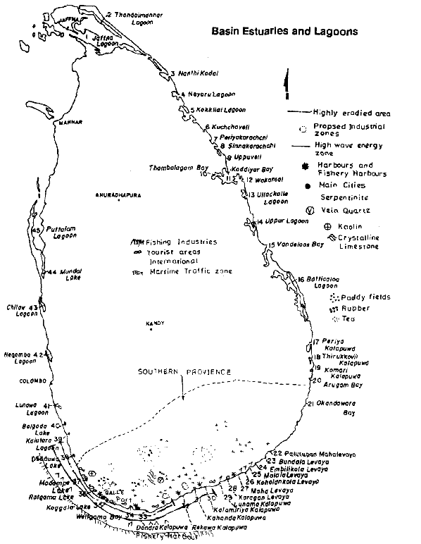
Basin Estuaries and Lagoons