| GISdevelopment.net ---> AARS ---> ACRS 1996 ---> Global Environment |
Rationality of the use of
Remote Sensing based Land Use Maps for Identification of Emerging Urban
Centres in Sri Lanka
L. H. Indrasiri
Urban Development Authority
7th Floor, Sethsiripaya, Battarmamulla, Sri Lanka
Tel : 94-1-874554, Fax: 94-1-873642
L. H. Indrasiri
Urban Development Authority
7th Floor, Sethsiripaya, Battarmamulla, Sri Lanka
Tel : 94-1-874554, Fax: 94-1-873642
Abstract
For quite a long time Sri Lanka was facing a problem in deigning its urban centres in a scientific manner and as such the status of urban was conferred on a Ministerial decision for local administrative purposes.
Since the urban centres considered as catalyst for regional development a new approach is necessary to be adopted for the identification and definition of urban centres in Sri Lanka. This paper make an attempt to explain how the land use maps prepared by the Survey Department was utilized for the identification, demarcation and estimation of population of the emerging urban centres of Sri Lanka.
1. Introduction
The government development objectives for the urban sector meant to create required condition for efficient economic system and to improve the standard of living, including housing and urban infrastructure.
The dominance of Colombo in the urban system in the country and continuous arguments on the slow pace of urbanisation with changing urban status due to classification problems has create certain specific problems related to the definitional problem of urban centres such as difficulties in the :
2. Application of Land Use Maps
The Homestead and urban built-up categories as indicated in the land use maps on the scale of 1:100,000 was wctracted as the settlement areas of Sri Lanka (Map. No. 1).
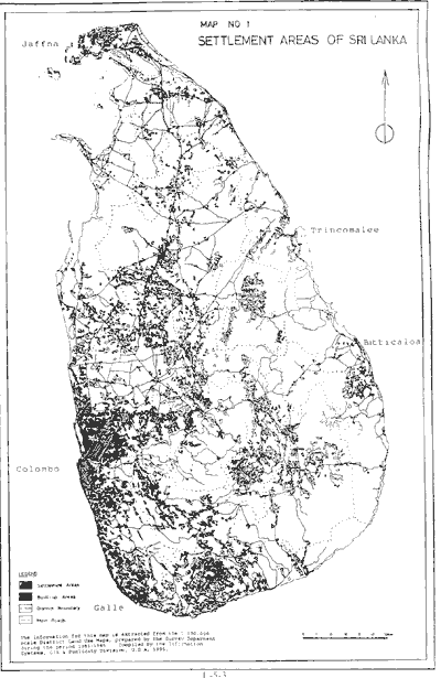
Map No 1 Settlement Areas of Sri Lanka
Taking into consideration of the factors such as:Table No. 1 : Projected total and
Urban Population - 2000 - Colombo Metropolitan Region
Table 2: Projected Total Population -
2006 -Southern Area
Note:
As urban though these centres have variations in size class in population and services.
Out of the 61 centres in the Southern Area and 57 in the Colombo Metropolitan Region as identified by the initial study 50 in the Southern and 51 in the CMR were recognized as urban centres in these two provinces. Only one centre was added as emerging centre. On the basis of the statistics collected the urban population was estimated as 33.6 percent of the total in Southern Area (Gali 43%, Matara 31.5%, Hambantota 31.5%) and 67.5% of the total in Colombo Metropolitan Region. (Colombo 92.6%, Gampaha 51.2%, Kalutara 43.3%) (See Table 1&2 for details).
In general it can be argued that more than 35 percent of Sri Lanka's population, now living in urban areas. The significant feature of urbanisation in Sri Lanka shows that is not a concentration of population in the urban centres, but expansion around already urbanized area. (Map No.2).
![]()
Map No 2 Existing Hierarchical Structure of Urban Centers
The land use maps supported to plot the boundaries of the expanded urban centres and the physical expansion of those centres provided that centres spread in vast areas then officially defined in early 1980's.
3. Conclusion
The follow up studies based on the initial identification of emerging urban centres within the highly urbanized provinces in Sri Lanka has proved that basic identification of the centres lead to consider that Sri Lanaka is presently having more than 330 urban centres. It further proves that its total urban population is around 30-35 percent of the total population. Therefore the land use maps prepared by the Survey Department requires to be up dated to show the present scenarios for the better understanding of the trends a and pace of urbanisation which are vital factors for urban and regional development planning in Sri Lanka.
For quite a long time Sri Lanka was facing a problem in deigning its urban centres in a scientific manner and as such the status of urban was conferred on a Ministerial decision for local administrative purposes.
Since the urban centres considered as catalyst for regional development a new approach is necessary to be adopted for the identification and definition of urban centres in Sri Lanka. This paper make an attempt to explain how the land use maps prepared by the Survey Department was utilized for the identification, demarcation and estimation of population of the emerging urban centres of Sri Lanka.
1. Introduction
The government development objectives for the urban sector meant to create required condition for efficient economic system and to improve the standard of living, including housing and urban infrastructure.
The dominance of Colombo in the urban system in the country and continuous arguments on the slow pace of urbanisation with changing urban status due to classification problems has create certain specific problems related to the definitional problem of urban centres such as difficulties in the :
- identification of emerging urban centres with size and class differences.
- Analyzing the trends and pace of urbanisation in relation to the economic development
- persisting slow pace of growth in relation to the spatial distribution of the functions as a result of not updating the boundaries of existing urban areas for nearly 35 years of existing urban areas for nearly 35 years in keeping with the pace of urbanisation
- formulation of an urban strategy based on a rational urban hierarchy
- examination of underlying factors of urbanisation pattern and confrontation of the associated impacts in relation to land use, concentration of population and provision of basic infrastructure facilities
- minimization of regional disparities in the provision of urban facilities and orientation of Government priority projects to crate multiple effects to regional growth
2. Application of Land Use Maps
The Homestead and urban built-up categories as indicated in the land use maps on the scale of 1:100,000 was wctracted as the settlement areas of Sri Lanka (Map. No. 1).
Map No 1 Settlement Areas of Sri Lanka
Taking into consideration of the factors such as:
- physical development pattern of the area
- Socio-economic status of the people as stated in official status of the people as stated in official statistics
- Major development projects implemented within the specified areas and
- Associated land uses in relation to the settlement pattern the
possible emerging urban centres were identified. tHis identification was
based on Divisional Secreaariat and District levels and listed the total
number as 337 in 1996. The status of the identified centres were as
follows :
- Census of population & Housing 1981
- Demographic Survey, 1994
- Based on average annual growth rate of 1994 and projection using the rate upto 2006 applying exponential growth model
- Based on Expected rate of grown calculated on the basis of
development potentials of the expanded urban aggomeration/ centres.
The rates vary from 1.0 to 4.0 percetn. The applicatble growth rates
for different DS Divisions are as follows.
Expected Rate of Growth of Respective DS Division 1994-2006 1.0% Balapitiay, Elpitiya, Hikkaduwa, Baddegama, Bope-Poddala. 1.5% Yakkalamulla, Niyagama, Nagoda, Akuressa, Malimpada, Thihagoda, Kamburupitiya, Hakmana, Mulatiyana, Tangalle, Beliatta 2.0% Weligama, Welipitiya, Matara, Devinuwara, Dickwella, Weeraketiya, Okewela, Kauwana, Pitabeddara, Pasgoda, Hambantota, Sooriyawewa, Ambalantota, Lunugamvehera, Tissamaharama 3.0% Moneragala, Buttala, Wellawaya 3.5% Embilipitiya, Kolonna, Thanamalvila, Kataragama 4.0% Neluwa
- Extent of identified urban agglomerations/ urban centres (Refer Table 7.2 for details)
- Urban population of the identified urban agglomerations/centres worked out on the basis of density level. (Refer Table 7.2 for detail)
- Expected rate of growth application to urban centres calculated based on the potential development and impact of urban activities in newly identified area.
| District | Total Population | Extent in Urban Area | Urban Population | |||||||||||
| Extent (ha) | Enumerated | Projected | (ha) | Enumerated | Project | |||||||||
| Gross | Residential | 2006 | Computed | |||||||||||
| 1981 | 1996 | 1981 | 1994 | 1996 | Low | High | 1981 | 1996 identified | 1981 | 1994 | 1996 | 2000 | ||
| Colombo | 69790 | 23320 (33.4%) |
28155 (40.3%) |
16699421 | 2007703 | 2009300 | 2159200 | 2366500 | 18130 (26.0%) |
291100 (41.7%) |
1264284 | 1842013 | 1863289 | 1929245 |
| Gampaha | 139870 | 71890 (51.4%) |
71775 (55.2%) |
1390862 | 1695728 | 1718300 | 1840000 | 2058900 | 13551 (09.7%) |
3779 (27.0%) |
388342 (27.9%) | 869104 (51.2%) | 880217 (51.2%) | 905561 (51.2%) |
| Kalutara | 159760 | 36600 (22.9%) | 41605 (56.0%) | 829704 | 937183 | 946300 | 994700 | 1100700 | 4516 (2.8%) | 11572 (7.2%) | 178071 (21.4%) | 351132 (37.5%) | 409793 (43.3%) | 415235 (43.3%) |
| Total | 369420 | 131810 (35.7%) | 146936 (40.0%) | 3919807 | 4640614 | 467300 | 499300 | 5526100 | 36197 (9.8%) | 78463 (21.2%) | 1830697 (46.7%) | 3062249 (66.0%) | 31553299 (67.4%) | 3250041 (67.5%) |
| Source : | 1. Census of Population &
Housing, 1981, Dept. of Census & Statistics 2. District Land Use Maps, 1981, Survey Department. 3. Demographic Survey, 1994, Dept. of Cenusus & Statistics. 4. Extents of Identified Urban Centres Based on Reconnaissance Survey, 1996 Urban Department Authority. 5. Population Projections by L.H. Indrasiri, U.D.A. | |||||||||||||
| District | Extent (ha) | Population | Urban Population | |||||||
| Enumerated | Projected 2006 | Extent (ha) of Urban areas (5) | Enumerated 1981(1) | Estimated 1994(6) | Projected 2000(6) | |||||
| Gross | Residence | 1981(1) | 1984(2) | Low (3) | High (4) | |||||
| Galle | 165160 | 4700 | 814500 | 953800 | 113000 | 1199000 | 16420 (10.0%) |
166371 (20.9%) |
410500 (43.0%) |
536700 (45.0 %) |
| Matara | 128250 | 39700 | 644000 | 754000 | 840000 | 947000 | 9390 (7.3%) |
71151 (11.0%) |
237250 (31.46) |
301800 (31.86 %) |
| Hambantota | 262250 | 38500 | 424300 | 518400 | 631000 | 680000 | 16380 (5.6%) |
41430 (9.7) |
163800 (31.5%) |
214100 (31.5%) |
| Moneragala | 394400 | 261100 | 170300 | 233800 | 315000 | 166800 | 7050 (3.0) |
- | 35250 (15.0%) |
57800 (22.1%) |
| Ratnapura | 56990 | 14800 | 104400 | 152000 | 216000 | 231000 | 2200 (3.9%) |
- | 33000 (21.7%) |
500600 (25.3) |
| Total | 1007350 | 166100 (16.5%) |
2157600 | 2612000 | 3115000 | 3223800 | 51440 (5.1%) |
278952 (12.9%) |
879800 (33.6%) |
1155000
(35.82%) |
Note:
- Residential areas based on the land use maps of Survey Department
- The development potentials of each urban centre was calculated on the basis of present and past trends of the economic development activities, the extent of potential lands of future urban development activities when the infrastructure facilities are improved, location of each centre corresponds with major infrastructure networks, level of present and possible employment opportunities and the growing Paterson of urban functions.
- The population growth rates of selected centres of Hambantota District was compared the 1981 data with the observed population data of 1993 collected by RDSC, University of Colombo. The assumed growth rates are relatively higher than the observed rate. Therefore the same assumption was generalized and made for other centres where ever such comparison could be possible to made.
As urban though these centres have variations in size class in population and services.
Out of the 61 centres in the Southern Area and 57 in the Colombo Metropolitan Region as identified by the initial study 50 in the Southern and 51 in the CMR were recognized as urban centres in these two provinces. Only one centre was added as emerging centre. On the basis of the statistics collected the urban population was estimated as 33.6 percent of the total in Southern Area (Gali 43%, Matara 31.5%, Hambantota 31.5%) and 67.5% of the total in Colombo Metropolitan Region. (Colombo 92.6%, Gampaha 51.2%, Kalutara 43.3%) (See Table 1&2 for details).
In general it can be argued that more than 35 percent of Sri Lanka's population, now living in urban areas. The significant feature of urbanisation in Sri Lanka shows that is not a concentration of population in the urban centres, but expansion around already urbanized area. (Map No.2).
Map No 2 Existing Hierarchical Structure of Urban Centers
The land use maps supported to plot the boundaries of the expanded urban centres and the physical expansion of those centres provided that centres spread in vast areas then officially defined in early 1980's.
3. Conclusion
The follow up studies based on the initial identification of emerging urban centres within the highly urbanized provinces in Sri Lanka has proved that basic identification of the centres lead to consider that Sri Lanaka is presently having more than 330 urban centres. It further proves that its total urban population is around 30-35 percent of the total population. Therefore the land use maps prepared by the Survey Department requires to be up dated to show the present scenarios for the better understanding of the trends a and pace of urbanisation which are vital factors for urban and regional development planning in Sri Lanka.