| GISdevelopment.net ---> AARS ---> ACRS 1992 ---> Digital Image Processing |
Automatic classification of
NOAA GVI data Set
Sunpyo Hong, Akira Inoue,
Takashi Tada, Kiyonari Fukue
Haruhisa Shimoda,Toshibumi Sakata
Tokai University Research and Information Center
2-28-4 Tomigaya, Shibuya-ku, Tokyo 151, Japan
Haruhisa Shimoda,Toshibumi Sakata
Tokai University Research and Information Center
2-28-4 Tomigaya, Shibuya-ku, Tokyo 151, Japan
Abstract
Recently, global mentoring of ecological environment has come a serious matter because of growing industrial human activities. Especially, monitoring, of vegetation, such as tropical forest, has been focused Satellite Remote Sensing technology has the possibility of global monitoring on ecological adaptation.
In this research, a method of global vegetation monitoring using GVI (Global Vegetation Index) data set made by NOAA (National Oceanic and Atmospheric Administration) is proposed. At first, clouds removing and illumination correction are performed on original data. and temporal / annual change of NDVI is extracted. Additionally, vegetation map is automatically generated by the adoption of automatic classification method for multi-temporal image data.
Introduction
There exist many studies of global vegetation monitoring using the same data set, but most of them use NDVI (normalized difference vegetation index) as only one feature. However from our past experiment, NDVI can provide only limited information for vegetation monitoring. Further, NDVI can not perfectly remove influence of illumination variation as well as atmospheric effects. Here, we propose a method utilizing radiometric correction and original channel 1, 2 and 5 data for vegetation monitoring.
Proposed Method
The following conditions are necessary for Remote Sensing data, which can be used to global vegetation monitoring.
- wide observation coverage
- high repetitive observation
- adequate spectral range for extracting vegetation
The data used in the experiments are as follows.
| Target sensor | : | NOAA AVHRR |
| Target area | : | entire of earth (55 S - 75 N) |
| Date of data | : | 1985 Apr. - 1989 Dec. |
| Size of data | : | 1024 x 2048 pixels |
| Coordinate | : | polar stereo |
| Used data | : | AVHRR Ch 1, Ch 2, Ch 5 and solar zenith angle |
The amount of the above data is about 400 Mbyte per one year, so the total amount is about 2 Gbyte, and Ch 4 data was not used because of high correlation to Ch. 5
Preprocessing
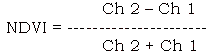
Weekly HVI data has been made of every days GVI data in order to minimize the amount of clouds. however, a lot of clouds still remain in weekly GVI data. so, remaining clouds were removed by generating monthly GVI data from 4 or 5 weekly GVI data at the preprocessing stage. Clouds removing were done by selecting pixels that NDVI is maximum. This processing was performed only on the land because there are no vegetation on the ocean. Next, illumination correlation was performed by cos 0 law, based on solar zenith angel data. Lastly, NDVI is calculated using illumination corrected image data, by the following equation.
The spectral range of Ch 1 is 0.58 - 0.69 micro meter, and that of Ch 2 is 0.725 - 1.1 micro meter. The characteristics of spectral reflectance for vegetation is low in Ch 1 and high in Ch 2, which is caused by chlorophyll. Fig. 1 shows the result to preprocessing, (a) is the original image data of a weekly data and (b) is the preprocessed image data. There are lots of clouds in the original image data, but little clouds in the preprocessed image data. and illumination has been corrected in the preprocessed image data.
Vegetation Mapping by automatic classification method
In order to establish an operational global vegetation monitoring system, an automatic change detection system for vegetation from GVI data set should be developed. An automatic change diction algorithm for multi-temporal data proposed by the authors(2) is applied to GVI data set.
Flow of this algorithm is shown in Fig. 2. First, initial training data is automatically extracted by overlaying the reference man to target image. because this initial training data has the changed pixels cause by the difference between reference map an target image, the changed pixels, which are statistically located far from the center of each class, are extracted from initial training data. Then clustering is applied to the extracted changed pixels in order to generate new classes. Next, new classes data is combined with modified initial training data, from which changed pixels are removed, to generate final training data. finally, with this final training data, maximum likelihood classification was performed on target image.
Fig. 3 shows the reference map which is used by automatic classification method. This reference map is based on the world vegetation map by Sychmithusen(3), and the vegetation is classified 13 categories in this map. Fig. 4 shows the vegetation map which is generated by automatic classification method using the referenced map of Fig. 3. Fig. 4 (a), (b), (c), (d) are results at different seasons, Jan., Apr., Jul., Oct., of 1989. From these results, following conclusions can be derived.
- This method is very useful for GVI data because the amount of GVI data is very large so automatic method is desired for treating GVI data.
- The vegetation maps, generated by automatic classification method, are a little different with seasons.
- This method use not only data but also infrared band data generated from Ch. 5 of AVHRR and admits additional data such as rain fall as another channel data.
A Method for global vegetation monitoring using GVI data set was studies. It has been clarified that temporal / annual change of tropical rain forest areas, arid areas, temperate vegetated areas can be well obtained using NDVI data. further automatic generation of vegetation map using automatic classification method is tested. This method used not only NDVI data but also infrared band data.
For further study, it is better to use not only GVI data but also meteorological data such as rain fall or ocean current in order to obtain more reliable and stable vegetation map.
References
- NOAA/NESDIS, "Global Vegetation Index User's Guide" Satellite data Source Division, National Climate Data Center, Washington D.C., U.S.A 1990.
- K. Fukue, et al., "A New Automatic Landover Classification Method with High and stable Accuracy for Multi Temporal Data", Inter Geoscience and Remote Sensing Symp. (IGARS'90), May 1990.
- Asahi newspapers, "Weekly Asahi Encyclopedia 080, The Geography of World, Special edition for Weather and Vegetation, 1985.
Fig. 1 Result of Preprocessing
Fig. 2 Flow of automatic classification method
Fig. 3 REference Map
Fig. 4 Vegetation Map by automatic classification method